
Precision
Access locally-calculated reference evapotranspiration (ET₀) values derived from meteorological data for optimal irrigation scheduling and decision-making.
Access locally-calculated reference evapotranspiration (ET₀) values derived from meteorological data for optimal irrigation scheduling and decision-making.
Evapotranspiration
ET₀Edge :
ET₀Edge is an advanced evapotranspiration management tool that delivers accurate ET₀ data to support crop-specific irrigation adjustments. Leveraging localized weather forecasting and predictive algorithms, the platform helps reduce water consumption while optimizing yield potential. Track daily reference evapotranspiration (ET₀) values and receive customized real-time notifications for more efficient and sustainable irrigation management.
Benefits

Water Savings & Efficient
Resource Management
The application enables data-driven irrigation, minimizing water wastage while ensuring optimal water supply based on actual crop water demand.

Enhanced Agricultural
Productivity
With up-to-date ET₀ values and accurate forecasts, growers can maximize crop yields by precisely matching irrigation to plant evapotranspiration.

Improved Decision-Making
& Risk Anticipation
By providing access to historical ET₀ data and weather trends, the app supports users in analyzing irrigation patterns and refining agronomic strategies for improved resilience and efficiency.

User-Friendly, Free,
and Accessible Application
Featuring an intuitive and ergonomic interface, ET₀Edge is designed for easy adoption—even by users unfamiliar with digital farming tools.
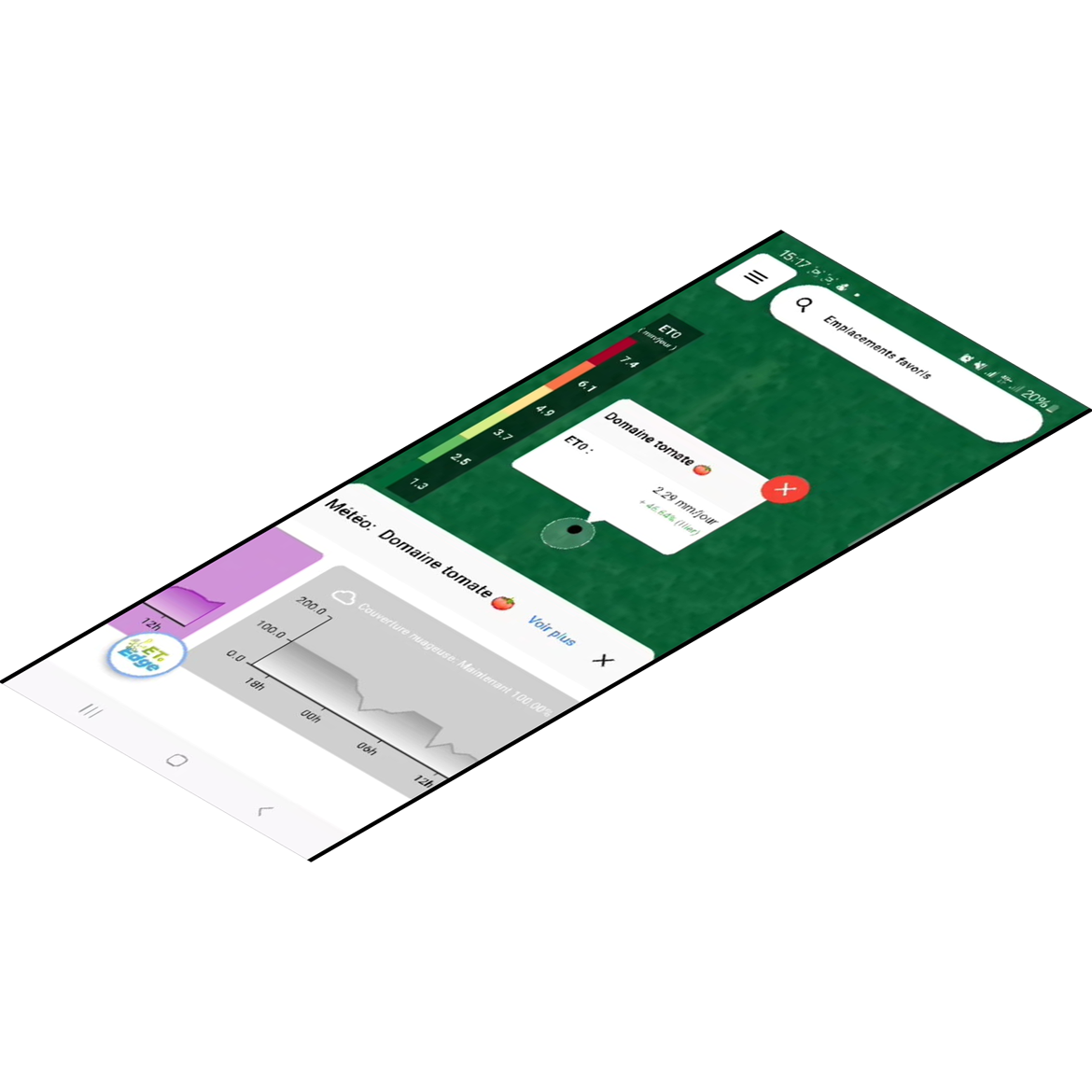
Daily Monitoring of ET₀ Values
ET₀Edge delivers daily reference evapotranspiration values based on localized meteorological data, allowing growers to align irrigation volumes with actual crop needs, avoiding under- or over-irrigation.
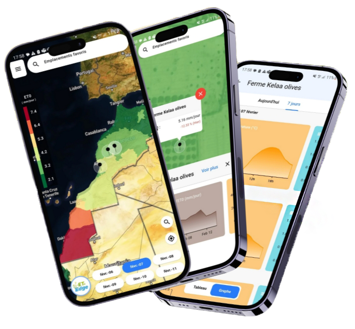
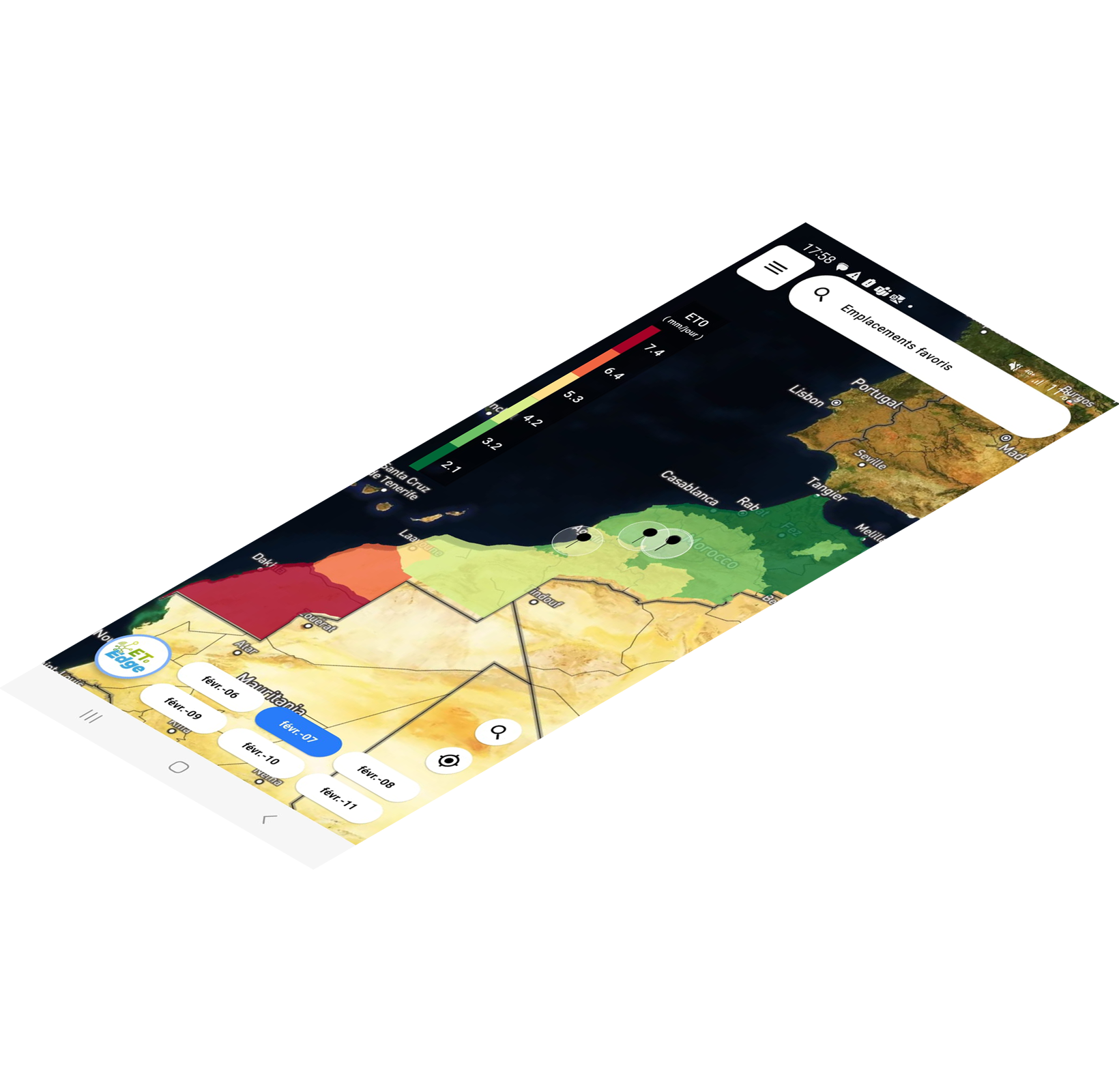
ET₀ Mapping & Forecasting
The platform generates ET₀ forecast maps for the next 5 days, along with access to previous values (D–1). This panoramic view helps farmers anticipate climatic fluctuations and refine irrigation planning both regionally and nationally.
Real-Time Notifications & Alerts
ET₀Edge sends personalized alerts when significant variations in ET₀ values occur, enabling immediate action during critical weather events or rapid evapotranspiration changes.


How does it work ?
Quick Registration – Create your account using only your phone number.
Farm Geolocation – Locate your field via multiple options: name search, map navigation, or manual GPS coordinate entry.
Favorites Management – Save your plots for faster access to associated data.
ET₀ Data Access – Monitor daily reference evapotranspiration and adapt irrigation accordingly.